PUBLISHED: Nov 30, 2013
DESCRIPTION:
Filmed by Stephen Cracknell and Ralph Emmerson
Music from the album On The Chalk (Our Navigation Of The Line of The Downs)
available on Static Caravan VAN 257
http://thememoryband.com/
http://thememoryband.bandcamp.com/
"So when I think of the individual, I am always inclined to see him imprisoned within a destiny in which he himself has little hand, fixed in a landscape in which the infinite perspectives of the long term stretch into the distance both behind him and before."
Fernand Braudel
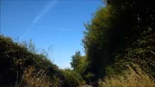
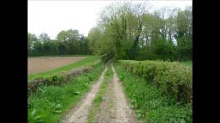
The fifth in our series of youtube slide shows and films in search of the Harrow Way is concerned again with the process of revisiting significant points along the route. In this case, the filming was done from a car driven by my old friend Ralph. We drove out to a junction where the Harrow Way merges with the A303 on the Hampshire/Wiltshire border and began filming as we drove back eastwards along minor metalled roads towards the land of our childhoods. We stopped several times to inspect our surroundings and enjoy a fine summers day just before the harvest would begin. Those of an ornitholgical disposition may be interested to observe a pair of Red Kite flying above a telegraph pole at around 2:16 in the film.
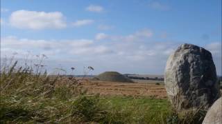
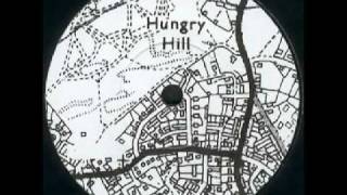
The film starts with a view of Quarley hill-fort. A pivotal point in the imagery and myth of the Harrow Way and in my investigation of it. Practically all the early writers on the Harrow Way mention it as one of the most ancient symbols of the lost road.
"A landmark difficult to escape in these parts of Hampshire, as its summit surrounded with a single bank and ditch, and crowned with a clump of trees, is never possible to mistake. Close at hand it is difficult to realize that its gentle slopes should stand out so distinctly when seen from distant uplands, where Quarley often proves useful in giving the direction of track-ways, and is as welcome to the view as Fuji is to the Japanese." R. Hippisley Cox "The Green Roads Of England" 1914
However Osbert Crawford, appointed in 1920 as the first Archeology Officer of the Ordnance Survey, wrote a series of papers which would eventually be published in 1924 as Air Survey and Archaeology. During the war he had served as a flying observer and was convinced of the value of aerial photography to archeology. In his paper he detailed how photographs he had taken over the hill-forts of Hampshire and Wiltshire showed that the hill-forts were not as old as previously believed.
"The air-photos depicted the pre-Roman hill-top camps literally in a new light, their grassy ramparts thrown into relief by sunlight and shadow. (One such picture is better than the most carefully-drawn hachured plan, for it is almost the thing itself.) But they revealed something much more exciting than this, for one could detect a faint inner ring within the outer ramparts of two of the camps. This inner ring appears to be unconnected with the rest and to be older than it."
"In the case of the second illustration, which is of Quarley Camp, Hants, both camp and ditch are visible on the ground, but the relationship between the two is made clear by the air photograph, which shows that the ditch was there when the camp was made. The camp, as a matter of fact, cuts through the ditch"
By the time archeologist Barry Cunliffe led a team to look at Quarley in 1990s it was considered a minor element of a much larger appraisal of the Danebury Ring group of hillforts to which Quarley belongs. Cunliffe was heavily influenced by the writings of those such as Fernand Braudel, and members of the Annales School in France, who stressed the importance of the "long duree" in history, At the end of the first section of Robert Macfarlane's fine book "Old Ways" he very markedly leaves the chalk ridgeways upon which he starts his navigation of ancient routes. Referring specifically to Cunliffe's work, Macfarlane continues the process of relocating British Landscape writing to the maritime edgelands and tidal seaways which Cunliffe identified as the dominant factor of influence on the history and development of our Island's identity.